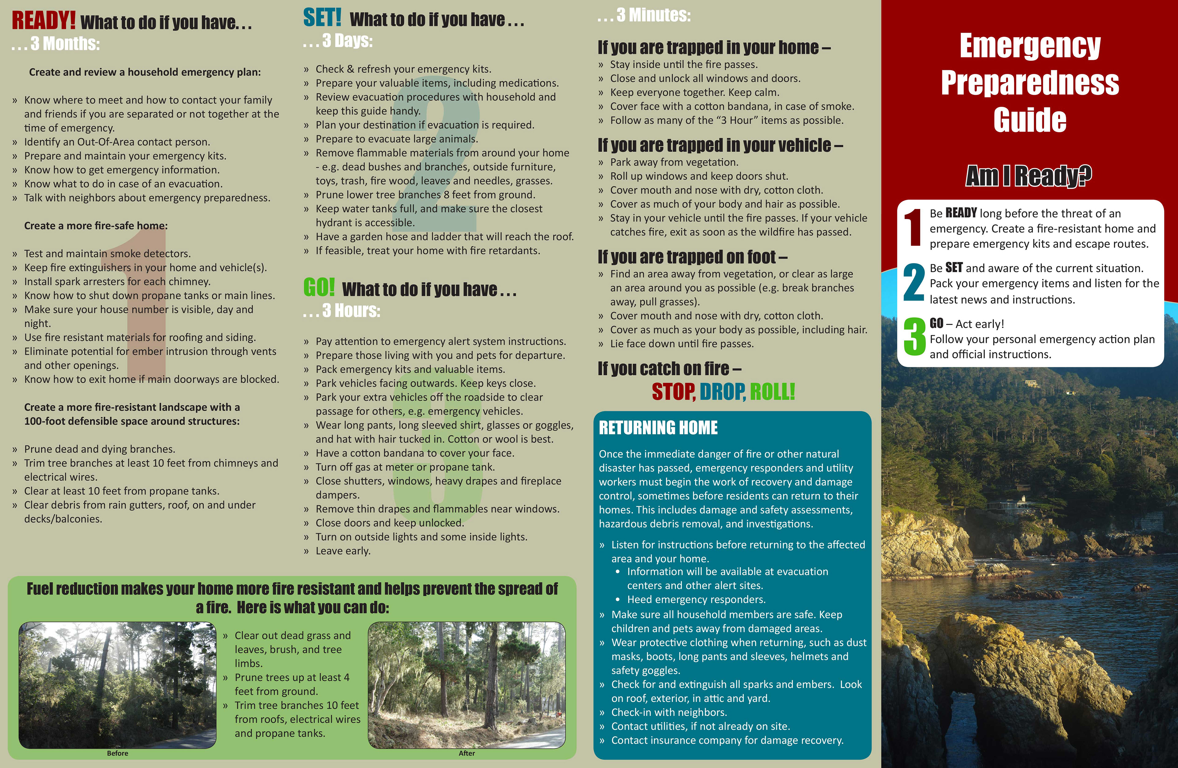
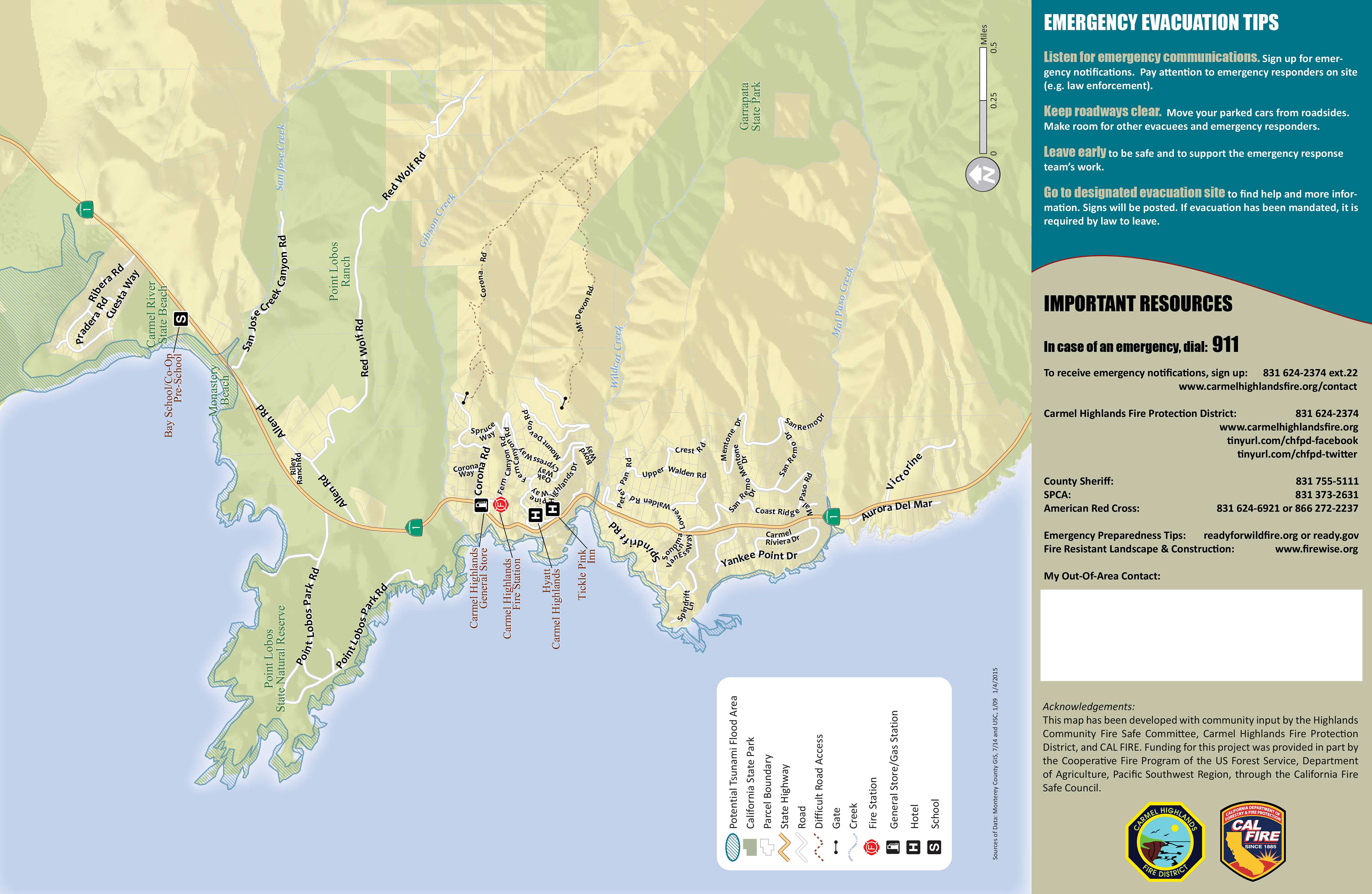
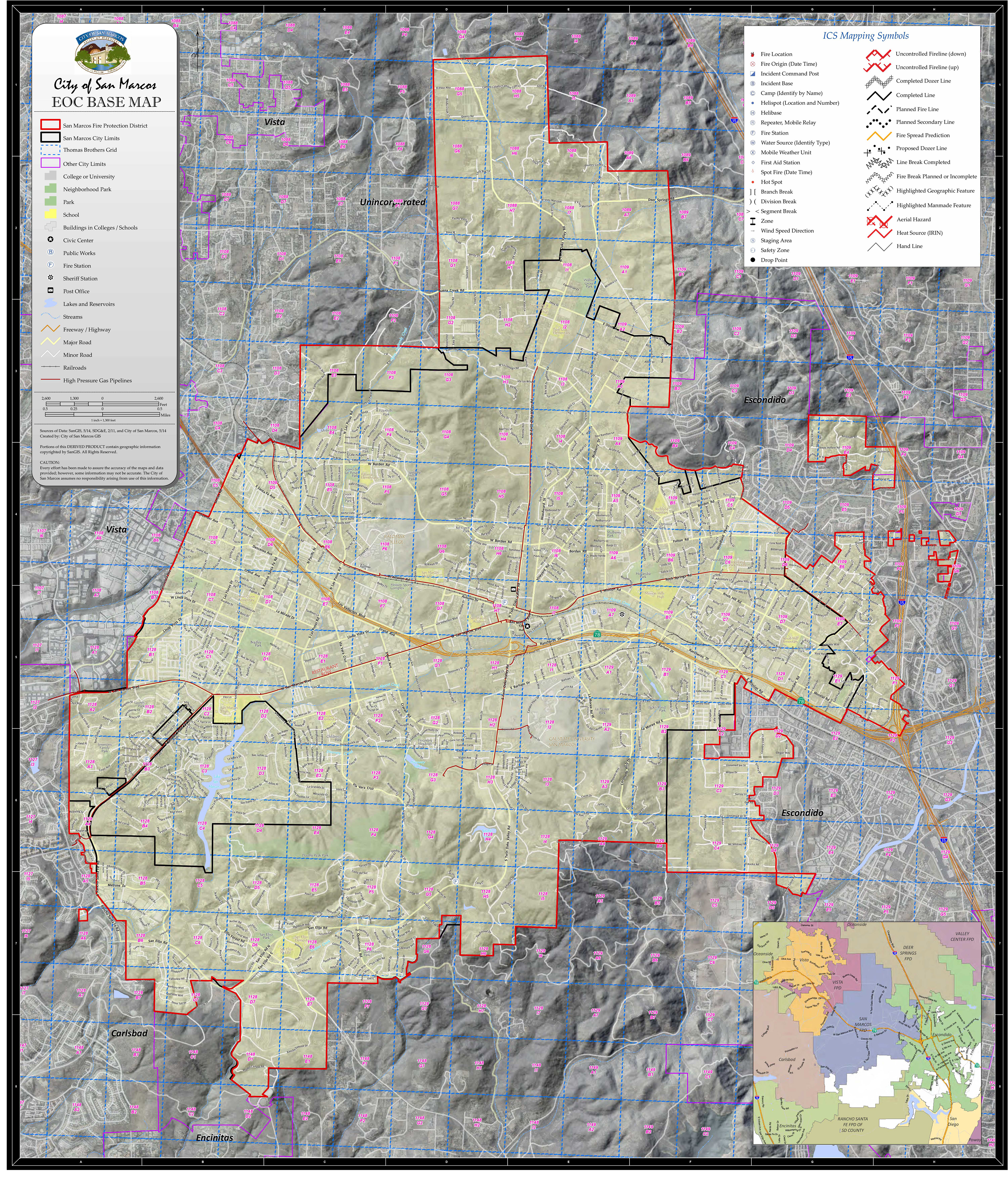
At San Marcos, GIS played an integral part in emergency preparedness. I developed a protocol for the EOC and implemented that protocol when the EOC was activated during a fire. I was also actively involved in the regional effort to create countywide fire run books, fire pre-plans, and database schema. In addition to the countless maps (and brochure) I created for Fire, I also managed a GPS project to assess and send letters to homeowners on the wildland urban interface.